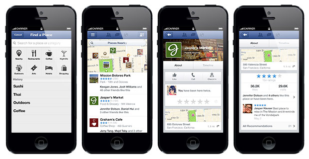
 You've probably managed to track down another app or two that accomplishes the same, or maybe you have no interest in a ratings-driven discovery platform at all -- either way, Facebook's decided to tap your smartphone's GPS yet again, offering up recommended venues through an updated Nearby. The new section lets you identify local establishments that your e-buds have checked into or liked. Businesses are sorted by category, so you can find a cozy coffee shop on a rainy day with ease, or stumble upon a neighborhood dog park that a special friend happens to frequent with her pooch. Perhaps most intriguing, however, is the suggestion that Facebook may "add places info from third party services in the near future," perhaps making the app a one-stop shop for all your cafe/club/shop/hotel-searching needs. You may already have a "Nearby" tab in your Android or iOS app -- Facebook has confirmed that the new tool will rollout beginning today.
[Source: Engadget]


